Ponta da Fajã on Flores: hamlet, 1987 landslide, waterfall road
Ponta da Fajã, at the end of the west-coast road on Flores, was evacuated after a 1987 rockfall; people still live there. The rules now and how to visit safely.
Free Azores app with a 3D map of the islands, weather by place and trail statuses. See how it works
The island's highest-rated guided trips, boat tours and tastings, ranked by the people who took them.
Most booking links go to Viator: if you book through them we earn a commission, at no extra cost to you. Each card names the site it books on, and prices and availability are that site's.
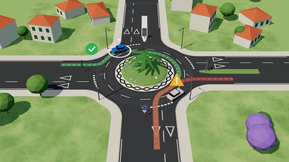
Driving in PortugalRoundabouts in PortugalWatch the 1-minute animationPonta da Fajã, at the end of the west-coast road on Flores, was evacuated after a 1987 rockfall; people still live there. The rules now and how to visit safely.
The three parishes on the road from Santa Cruz to Lajes had 76, 200 and 261 residents at the 2021 census. Caveira has the Ribeira da Cruz valley with its volcanic chimneys and the Poio Moreno spring at 24.8 °C, and a church opened in 1880 with emigrant money; Lomba has the São Caetano church, rebuilt in the 1750s and again in the 1880s; Fazenda, the last parish created on Flores in 1919, has the 1906 Senhor Santo Cristo church, a former NATO navigation station and the only restaurants on this stretch. What to see, the two Fazendas, the August festivals, and the weekday bus with its 2026 fares.
The two south-west parishes of Flores had 75 and 19 residents at the 2021 census. Off Lajedo the Cunard liner Slavonia ran aground in fog on 10 June 1909 with no lives lost; Mosteiro's 1846 church was paid for with a fortune made in Macau; the road between them runs under the more than 200 basalt columns of the Rocha dos Bordões, which the 2026 nature park plan closes to the public. What to see, the PR02FLO trail, the weekday bus with its 2026 fare, and the road after rain.
All three Flores hotels are in Santa Cruz, by the runway; most rentals are in the west around Fajã Grande, 22.4 km away. Which base to pick, and the campsites.
The Azores Geopark numbers 14 geosites on Flores, and nearly all of them can be seen from a road, a viewpoint or a boat. What you are looking at in each, from the 108-metre-deep Caldeira Negra and the 570,000-year-old columns of Rocha dos Bordões to the volcanic chimneys of the Ribeira da Cruz, the Pico da Sé lava dome and the Ilhéu de Monchique, and where to stand to see it.
Since August 2026 the Flores Nature Park plan bans leaving the trail on the plateau and landing on Maria Vaz. What it says on camping, drones and fishing.
Fishing, aquaculture and fish-processing companies can claim back part of the higher fuel costs they carried since February. Applications close on 30 November.
The 10:45 Horta to Madalena crossing will run without vehicle space from Monday to Saturday while the Atlânticoline ferry is in a Spanish shipyard.
Police link the suspect to fires in a garage, a car and four farm buildings on Flores between July and September. One fire put lives at risk.
The regional government expects the new port at Lajes das Flores, with a planned budget of 191.5 million euros, to be finished by April 2030.
BE/Açores urged the Regional Government to curb new Local Accommodation licences in high-pressure areas, rehabilitate vacant public buildings and expand public housing.
The Azores Government says housing policy will continue beyond the Recovery and Resilience Plan, while parties in the Regional Assembly pressed for more affordable homes and longer-term action.